


Prairie View Twp. Voting District, Wilkin County, Minnesota
About
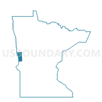
Outline

Summary
| Unique Area Identifier | 604876 |
| Name | Prairie View Twp. Voting District |
| County | Wilkin County |
| State | Minnesota |
| Area (square miles) | 35.08 |
| Land Area (square miles) | 35.04 |
| Water Area (square miles) | 0.04 |
| % of Land Area | 99.88 |
| % of Water Area | 0.12 |
| Latitude of the Internal Point | 46.58636650 |
| Longtitude of the Internal Point | -96.34219120 |
Maps


Graphs
Select a template below for downloading or customizing gragh for Prairie View Twp. Voting District, Wilkin County, Minnesota


Neighbors
Neighoring Voting District (by Name) Neighboring Voting District on the Map
- Atherton Twp. Voting District, Wilkin County, MN
- Humboldt Twp. Voting District, Clay County, MN
- Manston Twp. Voting District, Wilkin County, MN
- Norwegian Grove Twp. Voting District, Otter Tail County, MN
- Tanberg Twp. Voting District, Wilkin County, MN
- Tansem Twp. Voting District, Clay County, MN
- Trondhjem Twp. Voting District, Otter Tail County, MN
Top 10 Neighboring County Subdivision (by Population) Neighboring County Subdivision on the Map
- Norwegian Grove township, Otter Tail County, MN (300)
- Humboldt township, Clay County, MN (275)
- Tansem township, Clay County, MN (259)
- Prairie View township, Wilkin County, MN (196)
- Trondhjem township, Otter Tail County, MN (192)
- Atherton township, Wilkin County, MN (145)
- Tanberg township, Wilkin County, MN (69)
- Manston township, Wilkin County, MN (48)
Top 10 Neighboring Unified School District (by Population) Neighboring Unified School District on the Map
- Pelican Rapids Public School District, MN (7,434)
- Barnesville Public School District, MN (4,455)
- Rothsay Public School District, MN (1,057)
Top 10 Neighboring State Legislative District Lower Chamber (by Population) Neighboring State Legislative District Lower Chamber on the Map
Top 10 Neighboring State Legislative District Upper Chamber (by Population) Neighboring State Legislative District Upper Chamber on the Map
Top 10 Neighboring 111th Congressional District (by Population) Neighboring 111th Congressional District on the Map
Top 10 Neighboring Census Tract (by Population) Neighboring Census Tract on the Map
- Census Tract 302.02, Clay County, MN (4,528)
- Census Tract 9603, Otter Tail County, MN (3,420)
- Census Tract 9501, Wilkin County, MN (3,250)